Commentaries | Jun 11,2022


The Ministry of Agriculture (MoA) and the Agricultural Transformation Institute are to begin field studies in the Afar and Somali regional states, hoping to complete a national soil map that has been in the making for a decade. Experts have gathered data about soil fertility levels across the country, employing remote sensing satellite technology.
The duo has gathered and analysed 100,000 soil samples since 2015. There are 28 soil groups, with 18 classified as dominant, for they can be found in more than one regional state.
“Filed verification is essential to ascertain the accuracy of the results from samples collected earlier," said Girma Kassa, geospatial and agrometeorology expert at the Ethiopian Agricultural Research Institute (EARI).
The EARI is one of the entities participating in the project.
The low number of samples that have been taken in some areas is another reason for conducting field verification, according to Abebe Yerdaw, a geographic information systems expert at the Ministry. The samples underwent validation three years ago by 45 experts from universities and research centres. Field samples were extracted after digging down an average of two metres. The fieldwork will begin in the coming week, Abebe disclosed.
“It'll be finalised within a month,” he said.
This is not the first attempt at a national soil map. One had been prepared in 1970 with the Food & Agriculture Organisation's (FAO) support but has since been discounted. According to Abebe, it was designed with a small number of soil samples and had an accuracy of 28pc.
The agricultural sector has been characterised by low productivity, in no small part due to low soil fertility, an absence of balanced fertilisation and proper soil management. Agriculture accounts for 35pc of the GDP; it is a source of livelihood for nearly 80pc of the population.
The soil in Ethiopia lacks 16 essential nutrients, including nitrogen, potassium and phosphorous, according to Teklu Erkossa (PhD), a soil expert who participated in the validation process.
Until recently, farmers have been limited to using two types of fertilisers, urea and diammonium phosphate (DAP). This began to change when the Ministry released a preliminary fertiliser recommendation atlas to nine regional states in 2017. The following year saw the introduction of a new compound fertiliser – NPS, which contains nitrogen, phosphorous and sulfur. The use of DAP and urea has been waning since.
During the last Mehir harvest season, 1.92 million tonnes of chemical fertilisers such as urea, NPS and mixed fertiliser was applied on 10.1 million hectares of cultivated land.
“The major goal of the soil map is to change the blank fertiliser use, which has been shrinking productivity,” said Girma.
The project seems to have shown results.
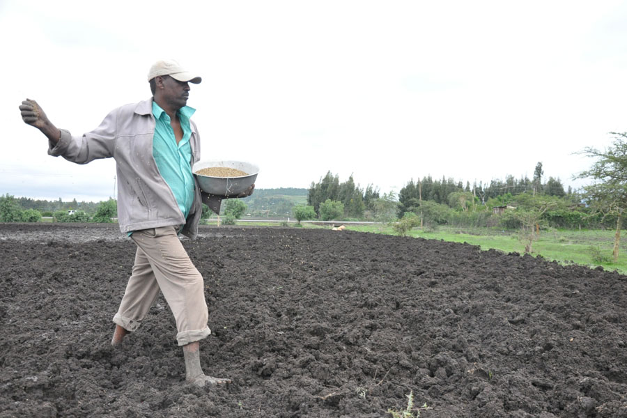
Ameha Abraham, a 54-year old farmer fathering four, used DAP and urea until 2019. He grows wheat and teff on 2.5hct of land in Adea Wereda, Bishoftu, 60Km southeast of the capital. His average yield was near 13 quintals of teff a hectare before he got his hands on NPS fertiliser.
"I reaped 19.5qtl of teff a hectare last harvest season," he told Fortune.
The yield was slightly higher than the national average of 18.8qtl a hectare recorded last year. Teklu, the soil expert, describes it as a significant step toward revitalising the soil management system.
According to Girma, applying the information gathered from the soil map project could easily double agricultural productivity quickly.
PUBLISHED ON
[ VOL
, NO
]
Fortune News | Oct 11,2020

Agenda | Nov 06,2021

Viewpoints | Aug 21,2021
Commentaries | May 31,2025
Agenda | Mar 19,2022

Dec 22 , 2024 . By TIZITA SHEWAFERAW
Charged with transforming colossal state-owned enterprises into modern and competitiv...
Aug 18 , 2024 . By AKSAH ITALO
Although predictable Yonas Zerihun's job in the ride-hailing service is not immune to...

Jul 28 , 2024 . By TIZITA SHEWAFERAW
Unhabitual, perhaps too many, Samuel Gebreyohannes, 38, used to occasionally enjoy a couple of beers at breakfast. However, he recently swit...
Jul 13 , 2024 . By AKSAH ITALO
Investors who rely on tractors, trucks, and field vehicles for commuting, transporting commodities, and f...

Jul 12 , 2025
Political leaders and their policy advisors often promise great leaps forward, yet th...

Jul 5 , 2025
Six years ago, Ethiopia was the darling of international liberal commentators. A year...
Jun 28 , 2025
Meseret Damtie, the assertive auditor general, has never been shy about naming names...

Jun 21 , 2025
A well-worn adage says, “Budget is not destiny, but it is direction.” Examining t...


 Loading your updates...